Santa Catarina · the second city
Balneário
Camboriú
Praia Brava · Barra Sul → Warung · 1 : 1

The same 500 m tile pipeline as São Paulo, pointed at Brazil's tallest skyline. 116 tiles from the Barra Sul jetty to the Warung Beach Club: real terrain, the 2021 widened beach from Sentinel-2, every street named with its CEP, and every building with a height and a confidence flag from the city's own 3D cadastre.
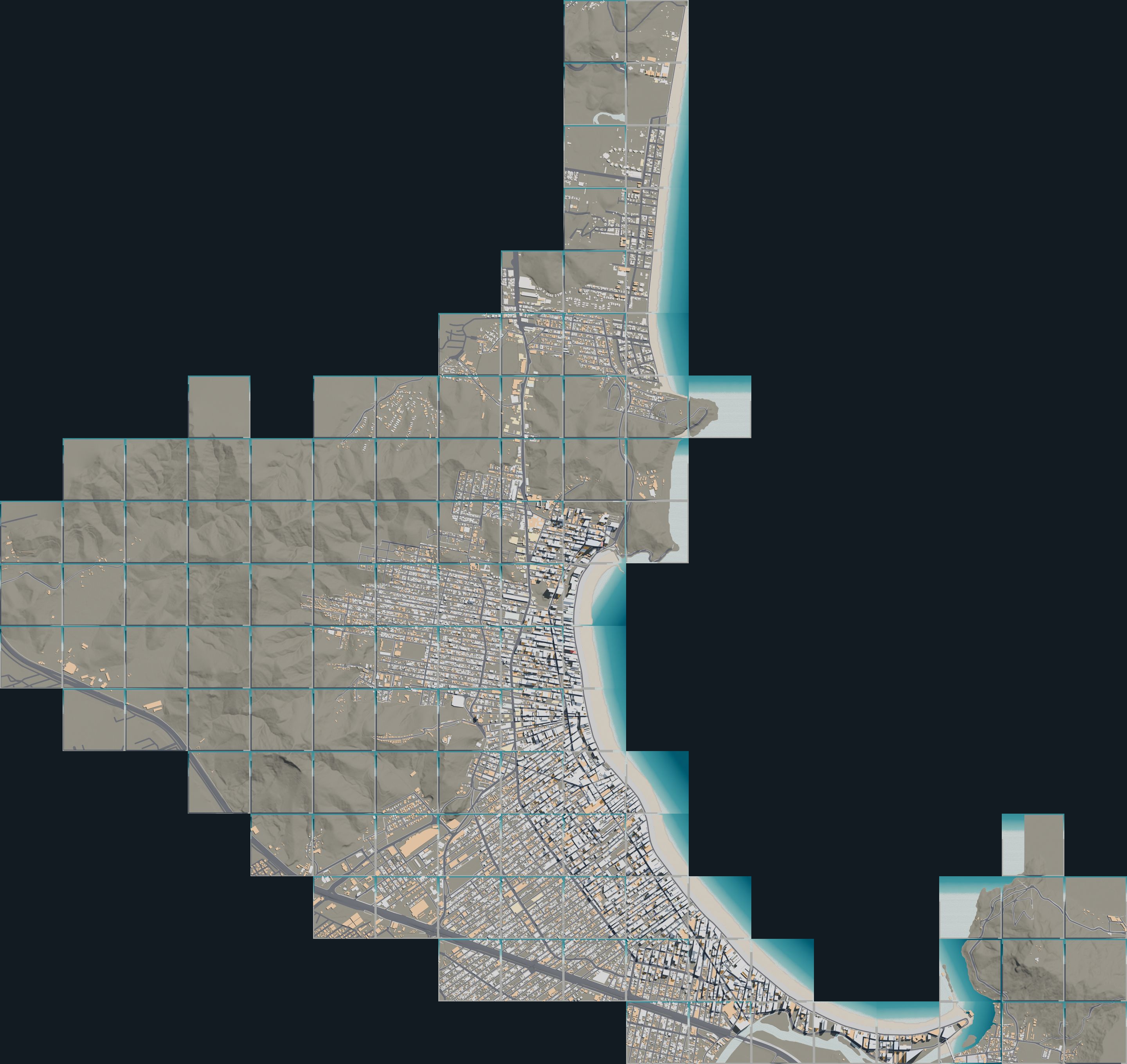
All tiles of Balneário Camboriú and Praia Brava seen from above
Map & tiles

Pick a tile

Click a tile for its top-down render. Hover a street to read its name, bairro and CEP; the list under the render carries the house-number range of each piece. Orange outlines are tiles still at checkpoint B (terrain and streets, no buildings yet).

Tile mosaic
selectedcheckpoint B onlycheckpoint C (buildings)

500 m tiles · grid north · origin at the Barra Sul tile centre (SIRGAS 2000 / UTM 22S)

—
Select a tile
Streets of the selected tile appear here with their CEPs.
Checkpoint C

Every building, with a flag

Balneário publishes a pseudo-3D cadastre: each building unit has a base level (cota) and a height (pe_direito), so podiums and towers come out as stacked parts. Checked against OpenStreetMap floor counts it agrees to a median ratio of 1.0. Where the cadastre was never surveyed the height comes from OSM, from a named-tower list (CTBUH), or from a flagged guess.

Height sources

Colours are the same in Blender: each confidence class is a material, so a provisional guess is never mistaken for a surveyed height. Praia Brava is in Itajaí, whose cadastre gives floor counts rather than heights.

The skyline

BuildingHeightSource

Heights from the CTBUH list are facts; the cadastre's values are municipal; "provisional" is a placeholder to be replaced.

Street names & CEPs

Rua 3700, CEP 88330-203

Balneário names its cross streets by number and numbers its houses by the metre: a house at 450 m from Avenida Atlântica is number 450, and Rua 2400 crosses the avenue at number 2400. The Correios ranges confirm it, so every piece of every street carries an estimated number range and the CEP that covers it.

  1. Names. OpenStreetMap ways are matched to the city's official street axes within 15 m; unnamed service roads take the official name. Praia Brava uses Itajaí's lot register.
  2. CEPs. One ViaCEP reverse search per street (Correios data), with the complemento ranges parsed into number intervals and sides.
  3. Numbers. Metric distance along the official axis from the origin end. The origin is fitted to known house numbers where there are any (OSM addresses, Itajaí lots); otherwise cross streets start at Avenida Atlântica and shore-parallel streets at their north end. Every unanchored range is flagged as an estimate.
  4. In the game. The same index feeds the blue corner plates and the street banner, as in São Paulo.
Data

Where it comes from

Every raw file is kept with its URL, fetch time and licence. Nothing here uses Google imagery.

LayerSourceDateNotes
Blocks, curbs, lots, buildings, 3D units, street axesPrefeitura de Balneário Camboriú GeoServer (WFS)2018–2025 editsno licence stated; the orthophotos are pre-widening and were not used for the shoreline
Praia Brava lots, buildings (floor counts), road widthsPrefeitura de Itajaí ArcGIS2023–2026no licence stated
Roads, footprints, names, addressesOpenStreetMap via OverpassOctober 2026ODbL, © OpenStreetMap contributors
ShorelineSentinel-2 L2A, 8-scene median 2025-12 → 2026-082026Copernicus Sentinel data; ±10 m
TerrainMunicipal 0.5 m contours (state 1 m survey when its server is up)2010–2024the state server has been down since October 2026, so every tile but one uses contours
CEPsViaCEP (Correios)October 2026one lookup per street, cached
Tower heightsCTBUH / Wikipedia list2026facts only, no content copied
What comes next

South of the river, then the road

The 25 tiles south of the Rio Camboriú (Barra, Interpraias) come next, then facades and the promenade detail for the new orla, then the 100 km scenic road links to São Paulo, Rio and Florianópolis described on the main page.